
Call of the Outer Coast: Sailing from Juneau to Yakutat

Sailing Alaska’s Outer Coast from Juneau to Yakutat
This year, with the call of the sea in our veins and the promise of unexplored horizons before us, Louie and I chose to set sail on a summer voyage brimming with the thrill of adventures and places new to both of us. Charting a course into the unknown and leaving the familiar shores of Southeast Alaska behind, our journey will eventually lead us to the shimmering waters of Prince William Sound and the wild landscapes of the Kenai Peninsula, continuing on to the legendary isle of Kodiak before finally steering our way back to the comforting embrace of Southeast Alaska at the end of the summer.

As the last whispers of winter receded, we set sail in May from Juneau, the city of gold, with the promise of spring upon our stern. Departing from the Inside Passage – a sanctuary of sheltered waters and verdant shores – we ventured towards the untamed majesty of the outer coast, where the seas speak the language of ancient mariners and the winds carry tales of uncharted adventures. Leaving Auke Bay’s Statter Harbor is navigationally straightforward, aside from the almost constant traffic of whale-watching vessels in the summer months. Our departing night brought clear skies and a late send-off, which soon gave way to a starry night. Shooting stars welcomed us as we reached our first port of call at the tip of the Chilkat Peninsula, Swanson Harbor, setting the tone for the journey ahead. Swanson Harbor has two public floats available for vessels to tie up to, free of charge. Above the floats, there is a beautiful sandspit giving sight into the lagoons of Couverden Island. The beach to the south of the floats is a wonderful place to collect beach greens such as goose tongue and sea asparagus, as well as wild berries. Mariners should beware that the sharp ledge contour around Entrance Island and other locations in Swanson Harbor have many rocks and are not very accurately charted.
Vintage map of Lynn Canal, Icy Straits & cross sound leading to the gulf of alaska

Sunset over the Chillkat Mountains on s/v Arcturus

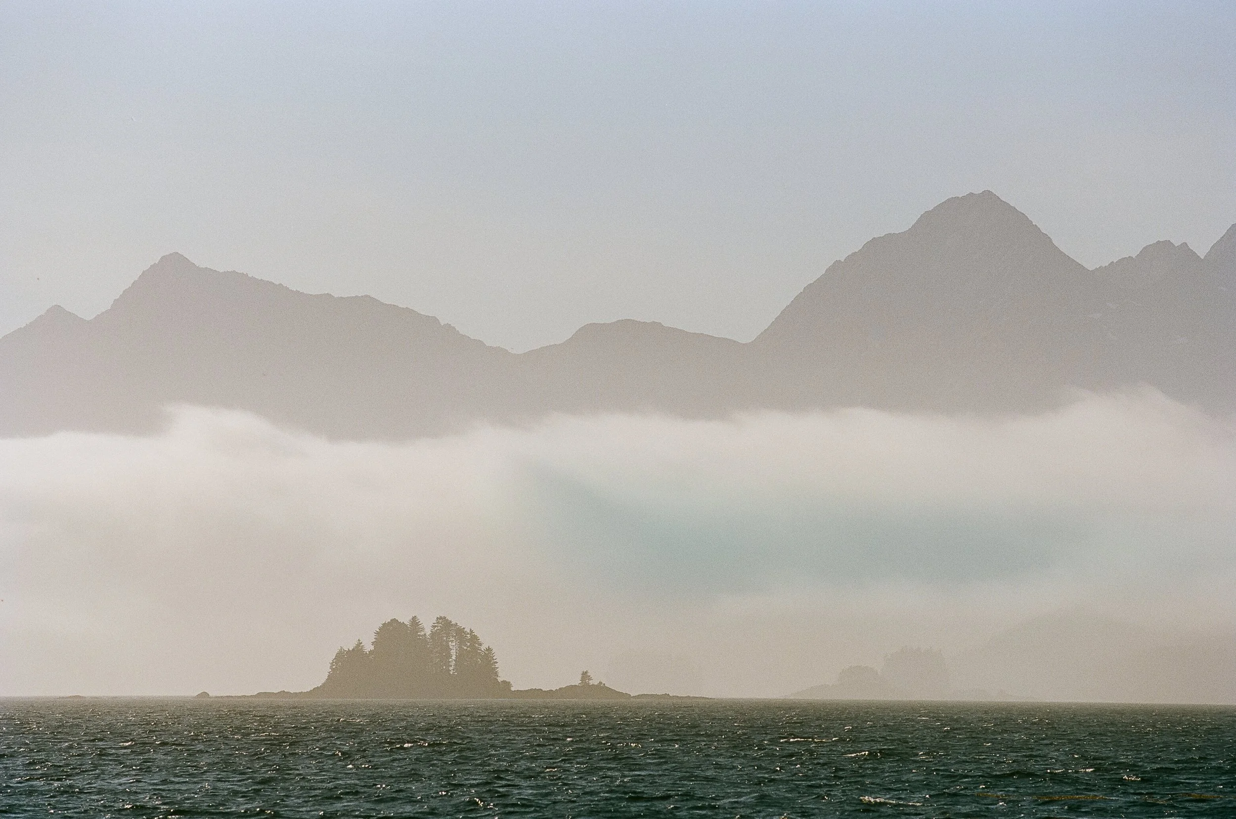
Shelter Island as seen from lynn Canal
The next morning, we sailed onward through the shifting blues and greens of Icy Strait. To the south, the rugged silhouette of Chichagof Island loomed on the horizon, its peaks draped in mist, hinting at the wild and unkempt landscapes that lay beyond. As we approached Gustavus and Bartlett Cove, the gateway to Glacier Bay, the landscape transformed. Here, the mountains rise like crowned pinnacles in the distance, their craggy peaks crowned with snow that never melts, even under the early summer sun. To enter Bartlett Cove means entering Glacier Bay National Park, which requires observing their protocols for checking in and out, as well as navigational protocols associated with marine mammals in the National Park. Mariners can tie up in Bartlett Cove at their large nice dock for up to 2 hours. Otherwise, vessels are required to anchor outside of the dock’s caution area. Getting from Bartlett Cove into the town of Gustavus is a fairly long distance; vehicle transportation is recommended. With its serene waters and tranquil beauty, Bartlett Cove offered us a moment of reflection before the journey ahead. The dense, mysterious forest whispered with the echoes of history, as if the very trees had witnessed the passage of time and the unfolding of countless adventures. The air, thick with the scent of pine and the earthy aroma of the forest floor, was a stark contrast to the salty tang of the open sea.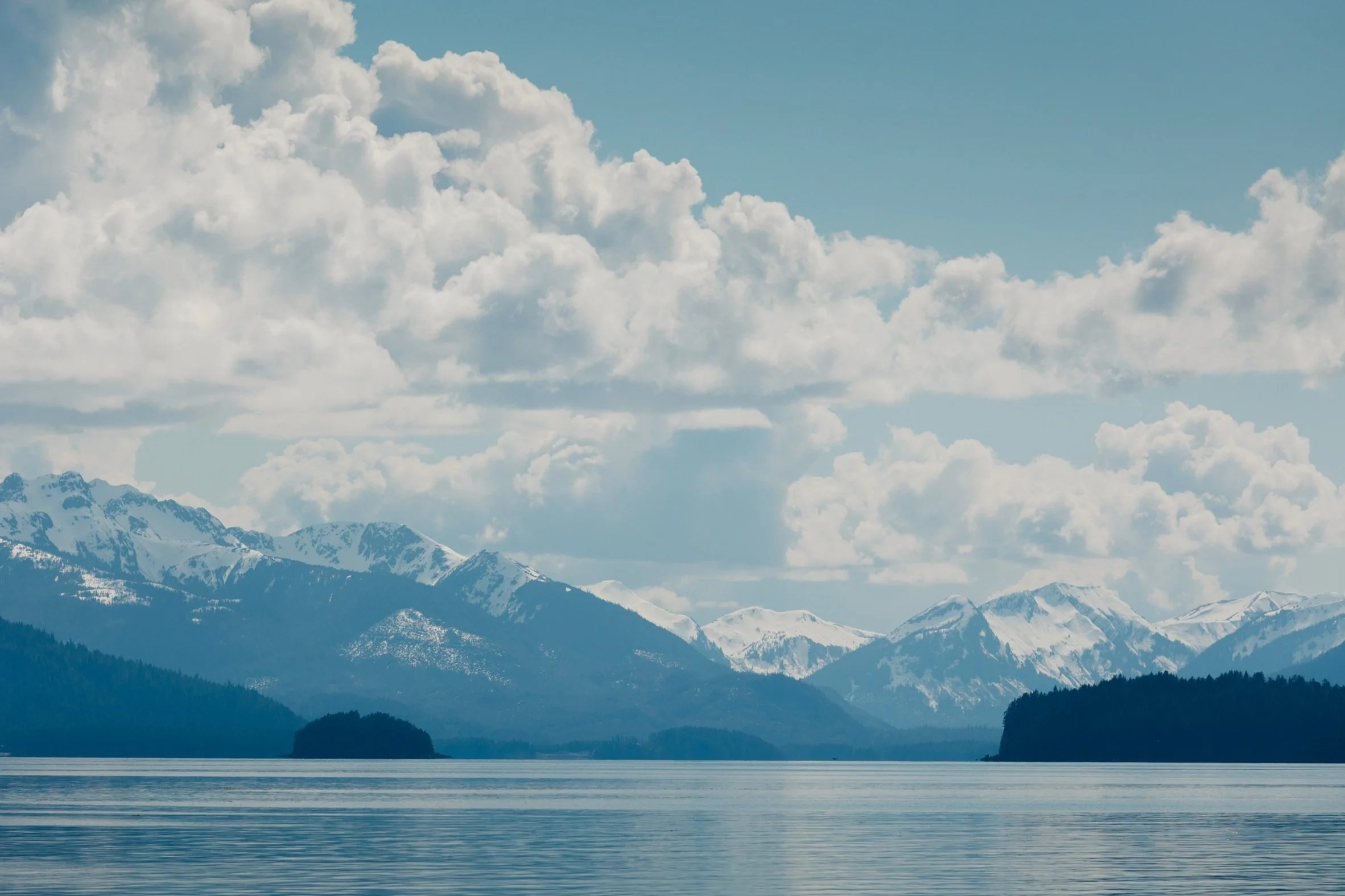
Chichagof Island as seen from icy Straits
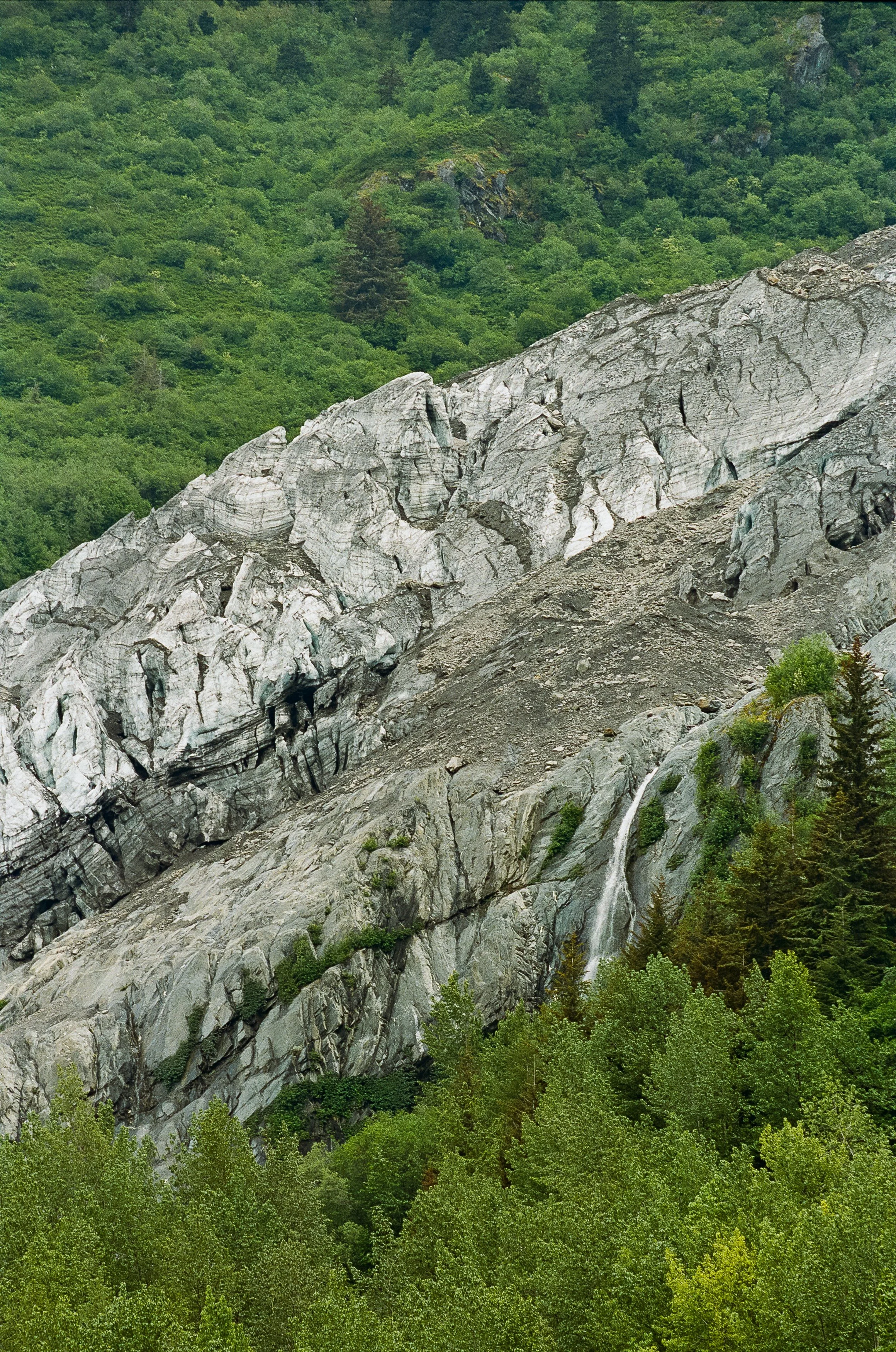
Venturing onward, the Inian Islands north of Elfin Cove beckoned us with their storied past. Entering these areas, mariners will encounter very high currents in both north and south passages of Lemesurier Island and the Inian Islands. The Inian Island south passage can flow at speeds greater than 7 knots; if current and swell are in opposing directions, very steep waves may be produced. The cove is fairly protected in most weather and offers reasonable anchoring in 60 feet of water. On George Island, the ghosts of World War II linger among the ruins, where silent cannons slowly succumbing to rust still stand, a stark reminder of a time when the world was at war and these isolated outposts were the front lines. Traveling to George Island, we anchored in Granite Cove, where the trailhead is located. We walked among the remnants of history, feeling the weight of the past and the echoes of a world that once was. Yet, the natural world around us was very much alive, and the vantage point from the cannon site was nothing short of awe-inspiring – across the churning waters of Cross Sound, the mighty Brady Glacier unfurled like a frozen river, its white-blue expanse stretching from the rugged mountains down to the sea. This glacier, one of the most significant in Glacier Bay, contrasts sharply with the lush green of the Inian Islands and highlights the dynamic forces that have shaped this landscape over millennia. From this perspective, the entrance of Glacier Bay seemed to open up like a secret, revealing a world of towering ice, deep fjords, and pristine wilderness. The view from George Island, with its juxtaposition of history and nature, served as a poignant reminder of the resilience and fragility of both human endeavors and the natural world. The ruins of World War II may crumble and fade, but the glaciers and mountains endure, their stories written in the very earth and ice that surround them.
Alaska's Inian Islands with Glacier Bay National Park and the fairweather range in the background

George Island, Alaska looking across cross sound

Inian Islands, Alaska

Glacier Bay NAtional Park and the Fairweather Range as seen from george Island's World War II cannon ruin site
Before setting sail north towards Yakutat along the outer coast, we ventured south through the narrow Lisanski Strait, winding between Yakobi Island and the sprawling wilderness of Chichagof Island. The strait led us to a maze of islands that dot Chichagof’s outer coast – each one a watchman standing guard over the secrets of the deep. The charts in this area are reasonably accurate and the area is riddled with rocky reefs, so keeping a close eye on kelp patches is recommended, as the absence of kelp determines the deepest channel. Navigating this labyrinth of rock can be especially tricky in rough seas, as waves break across this area with substantial power. Our journey soon led us to the secluded embrace of Mirror Harbor, where the promise of warmth and respite beckoned from White Sulphur Hot Springs. (See footnote at end of post for detailed navigational considerations for entering Mirror Harbor). The springs have long been a place of healing and solace, considered a sanctuary for Native Alaskan peoples for centuries, who revered these natural baths for their restorative qualities. Its name harks back to the early 20th century when it was renowned for its therapeutic waters, where explorers and prospectors traversing this untamed land in search of fortune also discovered the springs' soothing embrace. There is also a forest service cabin located at the springs which is reservable. Nestled in the heart of the wilderness, the springs’ mineral-rich waters bubble up from deep within the earth, their steam rising to meet the cool sea air. As we soaked in these rejuvenating waters, the world outside seemed to melt away, leaving only the serenity of the moment. The rugged coast of Chichagof Island, with its craggy cliffs and dense forests where waterfalls cascade from the peaks to the sea, felt like a world apart—a place where the worries of the world dissolved like snow in the sun, leaving behind only the pure, unfiltered essence of nature. 
White Sulphur Hot Springs as seen from the beach

White Sulphur Hot Springs BatH House (Interior)

White Sulphur Hot Springs BatH House (Exterior)
Chichagof Island from icy straits
With renewed spirits, we turned our bow northward, tracing the outermost edge of Glacier Bay, where the wilderness truly begins to feel untouched. Anchoring in any of the bays north of Cape Spencer is an excellent way to break up the journey between Cross Sound and Lituya Bay. Last summer was my first time witnessing this stretch of coastline, as Louie and I sailed 300 miles south along the rugged outer coast from Yakutat to Sitka with our friends visiting from Mexico City. Since that voyage, my heart has yearned to return to the glacial blue waters of Lituya Bay and the towering peaks of the Fairweather Range, whose majesty calls to me like an ancient, unending song.Their rugged faces are the result of eons of glacial activity, where ancient rivers of ice have sculpted the land into the dramatic vistas we see today. The glaciers that spill from these peaks are the lifeblood of this region, carving deep channels through the mountains as they journey towards the sea. The mountains rise with an almost intimidating grandeur, their peaks etched sharply against the sky—Mount La Pérouse (10,728 feet) and Mount Bertha (10,204 feet) came into view, followed by Mount Crillon, with its formidable 12,726-foot stature, standing guard near the mouth of Lituya Bay.As we navigate the waters, these mountains trace the invisible border between Alaska and Canada, standing like guardians of the wild frontier. Interestingly, our crew for this journey includes five fellow Alaskans and one Canadian from British Columbia. The contrast between Alaskan and Canadian culture became a frequent topic of conversation throughout our voyage. I couldn't help but chuckle when our Canadian crewmate confessed she had no idea that small towns like Petersburg and Wrangell even existed, as the Alaskan section on her British Columbia map is always shaded in gray, as if left unexplored and uninhabited.
Cape Spencer Lighthouse, Alaska, next to the entrance to Cross Sound and Icy Strait

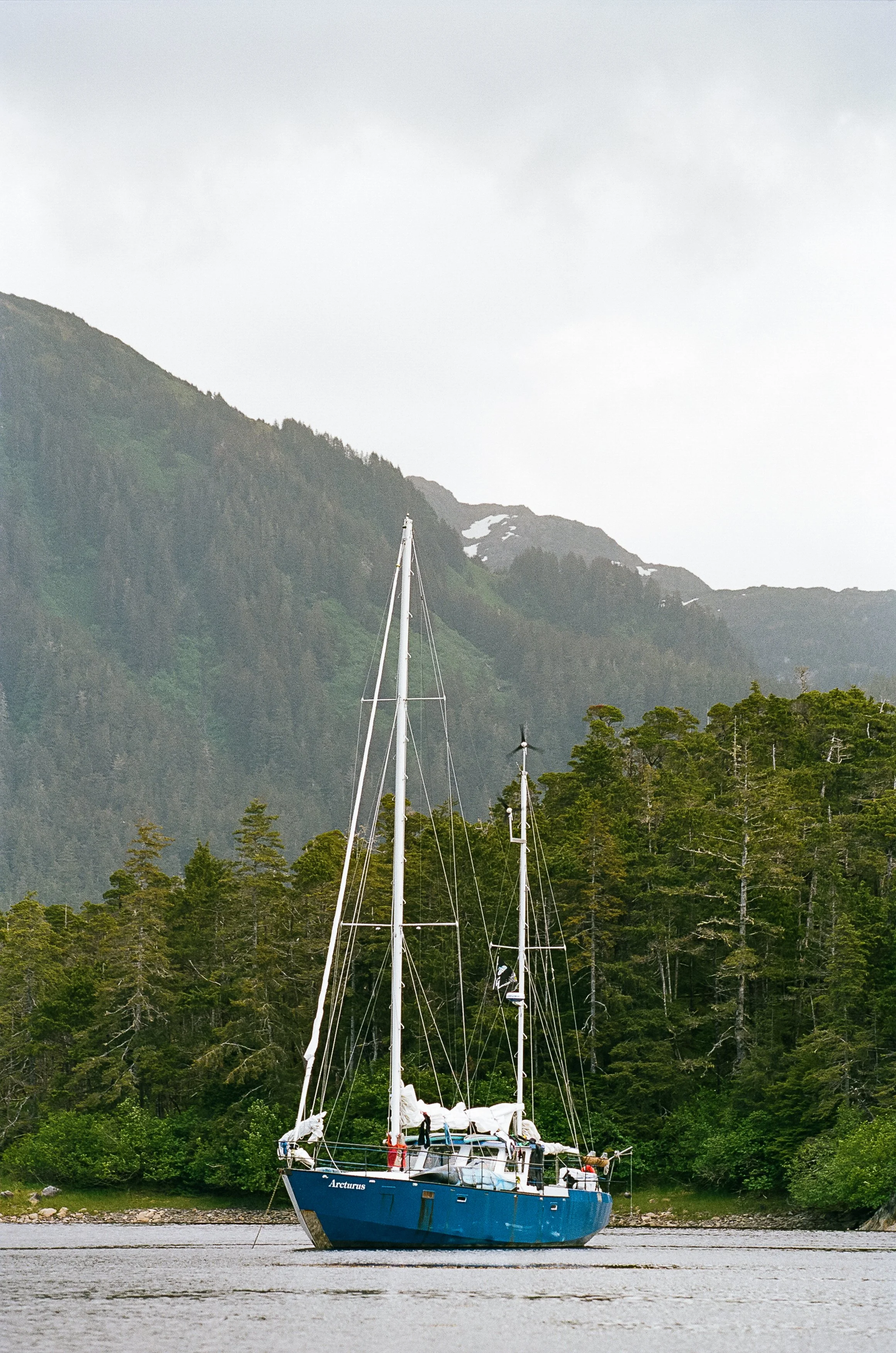
Gulf of Alaska and the Outer coast of Glacier Bay aboard S/V Arcturus

Sunset over The Gulf Of Alaska

Vintage Map of Alaska's outer coast from cross sound at cape spencer north to lituya bay and yakutat bay
We soon sailed into the mouth of Lituya Bay, a place both revered and feared by mariners. Entering Lituya Bay requires careful timing, as currents can reach up to 6 knots, both incoming and outgoing. Additionally, the combination of an outgoing current and a west swell can create a substantial wave train. As we passed Cenotaph Island, situated in the middle of the bay, the sheer grandeur of the three glaciers descending from the Fairweather Range became impossible to ignore: Lituya Glacier, flowing from the north, North Crillon Glacier, to the south, and Cascade Glacier at the eastern side of the bay, unique with its ice face cascading downward like a frozen waterfall. These ancient titans of ice, towering and magnificent, cast a spell over the bay, their frozen faces sculpted with the history of countless winters. Their immense presence seemed to whisper of time itself as they slowly, almost imperceptibly, crept toward the sea. The area at the back of the bay, overlooking these three glaciers, has recently been filled with glacial sediment that is not shown on any navigational charts—depths can suddenly change from 400 feet to nearly zero, meaning the “whale tail” shape shown on charts no longer exists. Cenotaph Island, nestled within the bay’s icy embrace, stands as a solemn sentinel in the heart of Lituya Bay. Here, amidst the serene beauty, one can feel the weight of the bay's storied past – the tragic tales of towering tsunami waves that once swept through these waters, leaving devastation in their wake. The island, named as a monument to those lost in these waters, is a place of quiet reflection, where the spirits of the past seem to linger in the air, mingling with the chill of the glaciers.
Entering Lituya Bay from The Gulf of Alaska

North Crillon Glacier, Lituya Bay, Alaska
Cascade Glacier, Lituya Bay, Alaska

Cenotaph Island in Lituya Bay with Cascade Glacier in the background
We departed the bay to sail north to Yakutat, a land where the mountains meet the sea in a dance of unparalleled grandeur. Traveling from Lituya Bay to Yakutat is a daunting 90-mile journey with no safe havens along the way, making it a significant commitment. Fortunately, we had access to satellite weather forecasts via Starlink, as VHF radio forecasts are unavailable in this remote section of the coast. That said, the Coast Guard can relay weather forecasts over VHF Channel 16. In past travels, without reliable weather forecasting, Louie has sometimes been forced to turn back to shelter in our 60-foot vessel due to foul weather. Fortunately for us, sailing north this time brought an unexpected tranquility to the Gulf of Alaska, where we found ourselves graced by gentle seas and a serene, whispering breeze. The waters lay still as we traveled onward to Yakutat, with scarcely a wave or gust of wind to stir our path—uncommon for May, and not ideal for sailing, but certainly better than battling against raging wind and waves.We passed Mount Fairweather, the highest peak in the mountain range at 15,325 feet, its summit often veiled in clouds despite the optimistic name given by Captain James Cook. In its towering presence, we couldn’t help but marvel at the irony of its moniker, knowing that this peak more often greets adventurers with storms rather than clear skies.
Icebergs calve off of Hubbard Glacier in Disenchantment Bay near Yakutat, Alaska
Yakutat, with its rich tapestry of cultural heritage and breathtaking natural beauty, stood as a poetic epilogue to this chapter of our voyage. It was a place where the ancient whispers of the land melded with the splendor of the mountains and sea, leaving us with a sense of reverence and wonder. As we prepared to set sail once more, parting ways with familiar faces and welcoming new souls aboard, Yakutat’s enduring spirit and serene majesty etched an indelible memory in our hearts. This tranquil sanctuary marked not just the end of a journey but the promise of new horizons yet to be explored.Adventures, Words & Photos by Lerina Winter & Captain Louis Hoock
Navigational considerations for entering Mirror Harbor from the Outer Coast: vessels can enter on either side of Fairway Rock into the Fleming Channel, which is very narrow and rocky. These rocks are plotted on Navionics® fairly accurately; however, looking for areas with the least kelp will help you find the deepest water. Once inside the channel, waves from the outer coast drop significantly, and the channel can be calm even in foul weather – befoulment in kelp and surging waves are the greatest dangers here. Once abeam the west arm, hug the shoreline of Fleming Island closely—in our boat, that meant we were so close we were able to pull leaves off of nearby trees. Entering the channel of Mirror Harbor, there is a rock set off the same shoreline that we followed so closely; take to the north side of the channel, then make a hard turn back to Fleming Island, skirting around this rock. The rocks on the north side of the channel extend far into the channel—it is recommended to have a crew member spot for rocks on deck, as the rocks average 8-feet deep in a 6-foot tide. Next, you should see loose rock along the shoreline of Fleming Island at its northern tongue. Navigate very close to that loose rock, which happens to be remnants of an abandoned nickel mine. Continue into Mirror Harbor, where you will find a clay-bottom bowl that is 22 feet deep, suitable for weathering out severe storms. To get to the springs, you will need to travel via small watercraft up the west arm. The trailhead is marked on Navionics®, and you will see a wooden triangle at the trailhead. Beware, the mud in this cove is extremely sticky and stinky.